ITRF2020-u2023
Description
Three years after its release, the ITRS Center has initiated regular (yearly) updates of ITRF2020 motivated by a number of reasons, including:
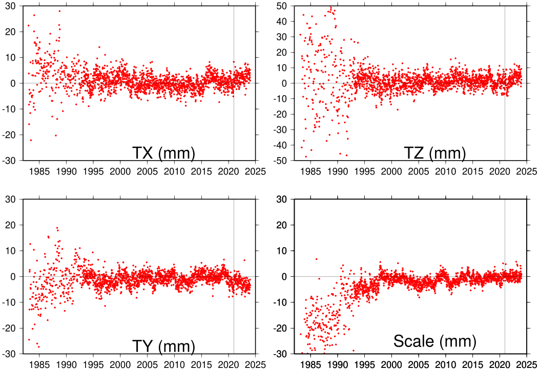
- the stability of the ITRF long-term origin, evaluated to be at the level of or better than 5 mm and 0.5 mm/yr for its time evolution,
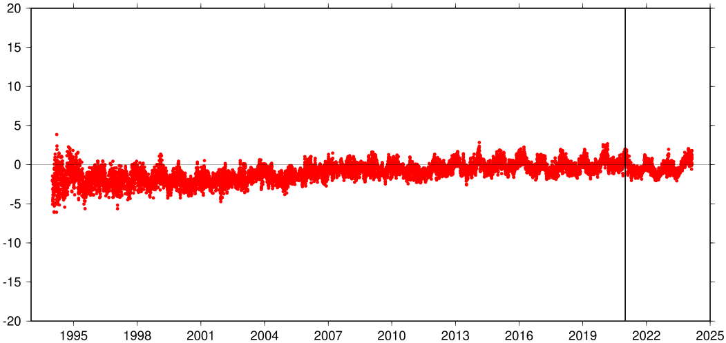
- the agreement in scale between VLBI and SLR, at the level of 1-2 mm, with no drift,
- the growth of extrapolation errors of the ITRF2020 coordinates beyond the end of the ITRF2020 input data,
- changes in the positions of certain ITRF2020 stations (due to, e.g., earthquakes and equipment changes) that occurred after the end of the ITRF2020 input data.
ITRF2020-u2023 is the first ITRF020 update, generated by adding three years (2021.0 – 2024.0) of data after the end of the ITRF2020 input data. The four Technique Centers (IDS, IGS, ILRS, IVS) who provided three years of extended time series of station positions and Earth Orientation Parameters (EOPs) were asked to use the same models and strategies as in their contributions to ITRF2020.
ITRF2020-u2023 keeps the same frame parameters (origin, scale and orientation) as ITRF2020. This is intended to avoid any “datum” change in user applications.
The computation strategy of ITRF2020-u2023 is identical to that of ITRF2020 (see ITRF2020 computation strategy).
Input data
Solutions from the four space geodesy techniques. The input time series of space geodesy solutions are summarized in the following table, indicating for each one, the time span and the type of constraints.
Frame Definition
ITRF2020-u2023 is aligned in origin, scale and orientation to ITRF2020 by means of no-net-translation, no-net-scale and no-net-rotation constraints. These constraints were applied to both the ITRF2020-u2023 long-term linear station coordinates and seasonal (annual and semi-annual) station motions.
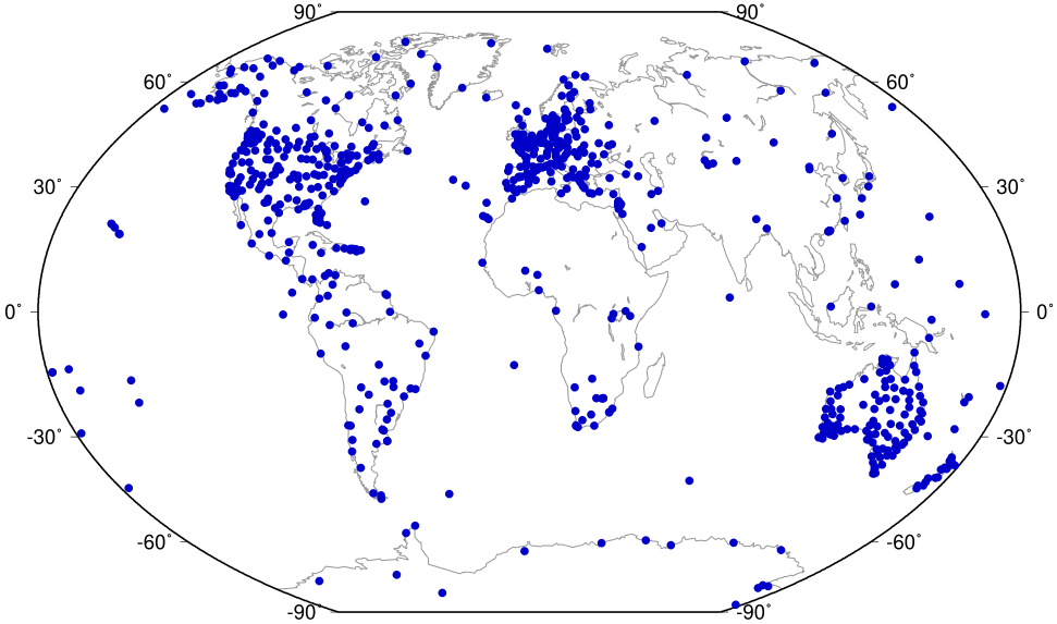
A reference network of 815 stations, whose linear coordinates and seasonal motions were hardly affected by the addition of three more years of input data, was used for the alignment of ITRF2020-u2023 to ITRF2020. See a list of these stations here and their distribution below:
The alignment of ITRF2020-u2023 to ITRF2020 implies that there is no Helmert transformation between the two solutions, i.e., all transformation parameters between ITRF2020-u2023 and ITRF2020 are zero. Transformation parameters from ITRF2020 to past ITRFs are available here.
Unlike individual seasonal station motions, the ITRF2020 seasonal geocenter motion model was not updated with ITRF2020-u2023.
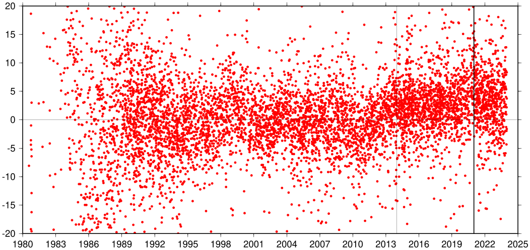
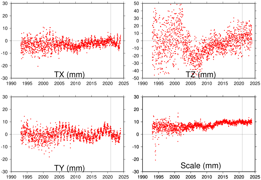
Scale and geocenter time series
ITRF2020-u2023 files
The ITRF2020-u2023 files are available via FTP:
 ftp itrf-ftp.ign.fr
 cd pub/itrf/itrf2020-u2023
or directly from the table below.
Long-term linear station coordinates
Available in SINEX format with (.SNX.gz) or without (.SSC) covariance matrix and in text tables (.txt):
Station position and velocity discontinuities
Post-seismic deformation models
Available in SINEX format (.snx) and in CATREF internal format (.dat):
Seasonal station motions
Available in SINEX format (.snx) and in CATREF internal format (.dat):
EOP time series
Local tie residuals
| Description | Download link |
|---|---|
| Discrepancies between local ties and space geodesy station position estimates | .dat |
Acknowledgement
The IERS ITRS Center is indebted to the Technique Services (IDS, ILRS, IGS and IVS) and their Analysis and Combination Centers for their contributions. The quality of ITRF2020-u2023 is certainly benefiting from that of the technique solutions. Many institutions and individuals have thus contributed to the ITRF2020-u2023 project. We also acknowledge the contribution of the DGFI-TUM and JPL ITRS Combination Centers to the ITRF2020-u2023 analysis. The IERS ITRS Center is particularly grateful to all the institutions that provide the necessary investment for the space geodetic observatories which constitute the main ITRF foundation.
Citation
ITRF2020 paper:
Altamimi, Z., Rebischung, P., Collilieux, X., Métivier, L., Chanard, K. (2023) ITRF2020: an augmented reference frame refining the modeling of nonlinear station motions. Journal of Geodesy, 97(47). https://doi.org/10.1007/s00190-023-01738-w
When using data through this website, please cite:
Altamimi, Z., Rebischung, P., Collilieux, X., Métivier, L., Barnéoud, J., Chanard, K., and de La Serve, M. (2024) ITRF2020-u2023 [Data set]. IERS ITRS Center Hosted by IGN and IPGP, https://doi.org/10.18715/IPGP.2025.MH0MEM4R
